
What we are aiming for
DEMODRIVERS aims to reconstruct human demography in SW Amazonia during the Holocene, shedding light on the impact of environmental and cultural changes. Despite decades of research, determining the relative importance of environmental versus cultural factors in prehistoric population growth remains a significant challenge in archaeology. This challenge persists due to the fragmentary, incomplete, and biased nature of archaeological records. DEMODRIVERS is designed to overcome this issue.
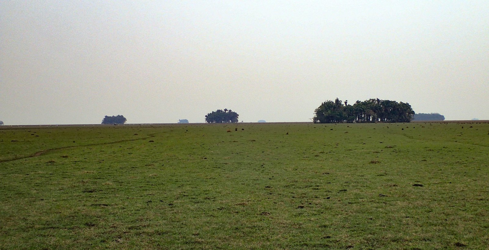
This interdisciplinary project spans five years and focuses on a regional case study: the Llanos de Moxos in the Bolivian Amazon. This area possesses a uniquely extensive archaeological record, comprising 4700 sites spanning 8300 years across 100,000 km2. These sites, known as forest islands (FIs) or islas de monte in Bolivia, are elevated earthen structures in seasonally flooded savannahs. Remaining above water year-round, they support tree growth, creating forest islands within a sea of savannah.
This record is unparalleled globally, offering a rare opportunity to quantify how demographic trends responded to exogenous (climate, landscape) and endogenous (culture, technology) variables. The project takes an unconventional approach, measuring occupation density, spatial distribution, and temporal boundaries by studying 150 stratigraphic cores from 100 evenly distributed archaeological sites. The interdisciplinary methodology integrates conventional archaeology with state-of-the-art geoarchaeology, biomarkers, paleoclimatology, palaeoecology, and artificial intelligence.
The results will provide a thoroughly documented case study, enabling comparison with models and reconstructions based on incomplete, fragmented, and biased datasets. The implications of this project extend across various disciplines.
Work Packages
DEMODRIVER has three main goals, which will be achieved through the execution of 10 work packages: 1) The reconstruction of paleo-demography in the Bolivian Amazon (WP1 – WP4); 2) Revealing the timing of cultural changes and technological innovations (WP5-WP7); and 3) Reconstructing environmental change in the LM during the Holocene (WP8-WP10).
WP1 – Survey and mapping.
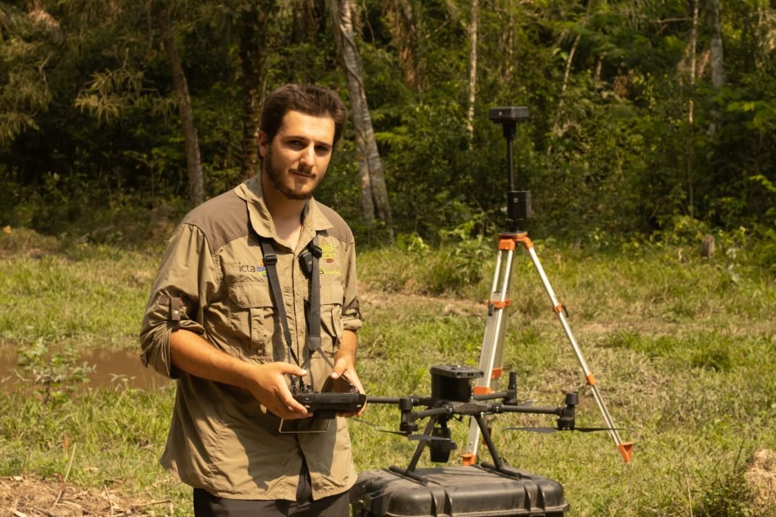
Forest islands are currently being mapped using a Lidar mounted on a drone, enabling the rapid acquisition of high-definition terrain surfaces. Albert pre-programs the drone’s path for each site, covering the entire forest island along with a 20-meter buffer of the surrounding savannah. The digital elevation models obtained through this process will be utilized to determine the precise volume of each forest island. This data will subsequently be employed to calculate population density. This mapping operation is conducted concurrently with the coring process.
Find the resultsWP2 – Coring
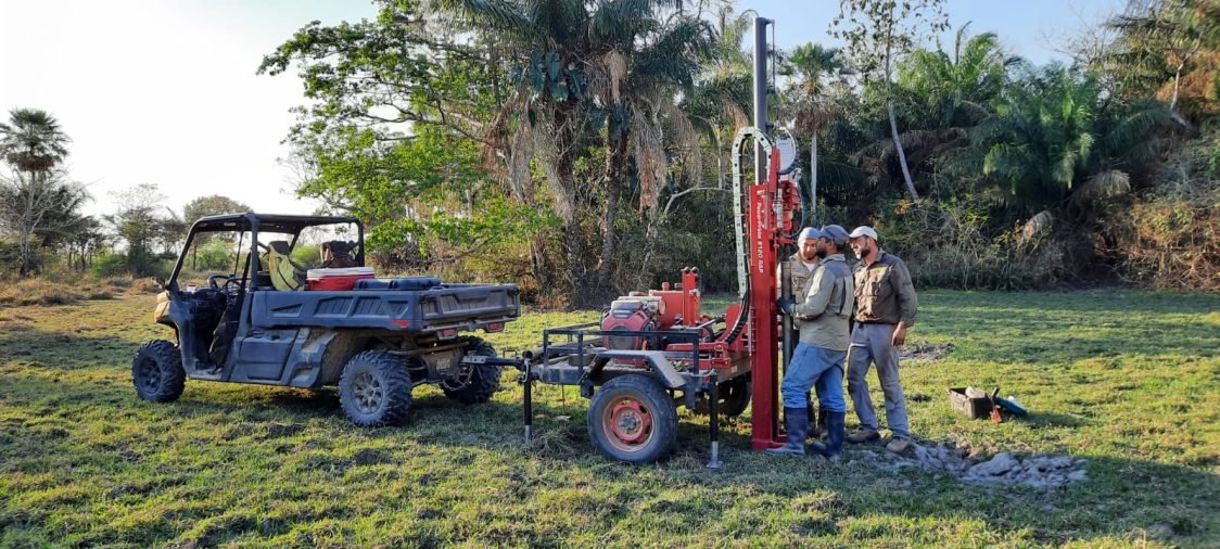
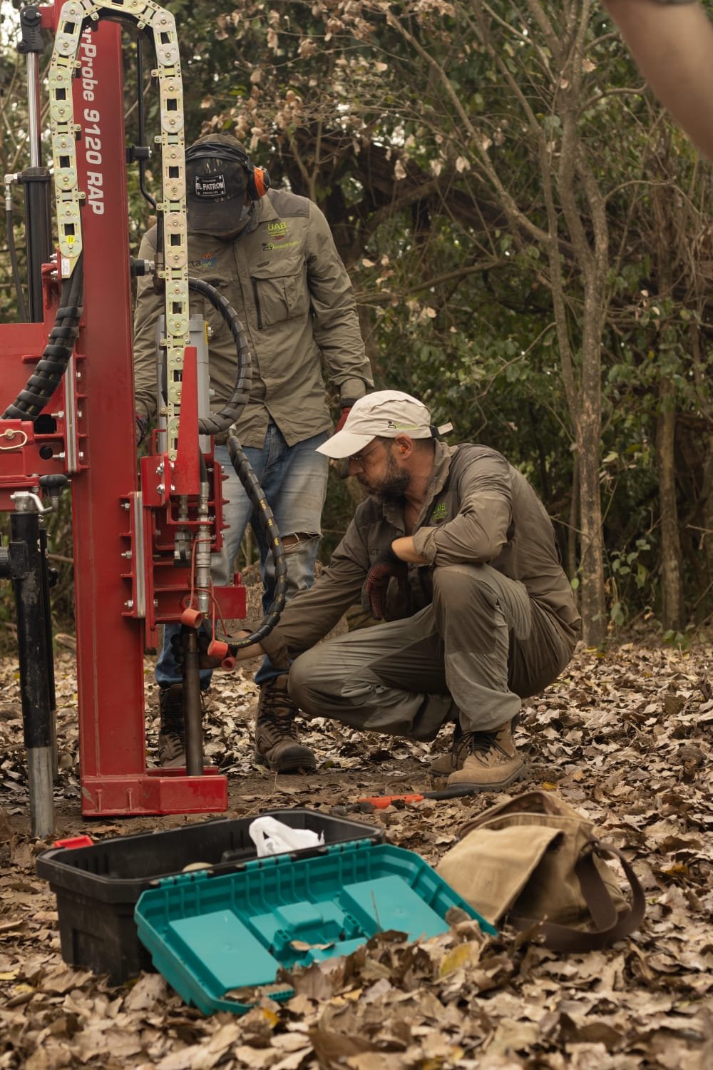
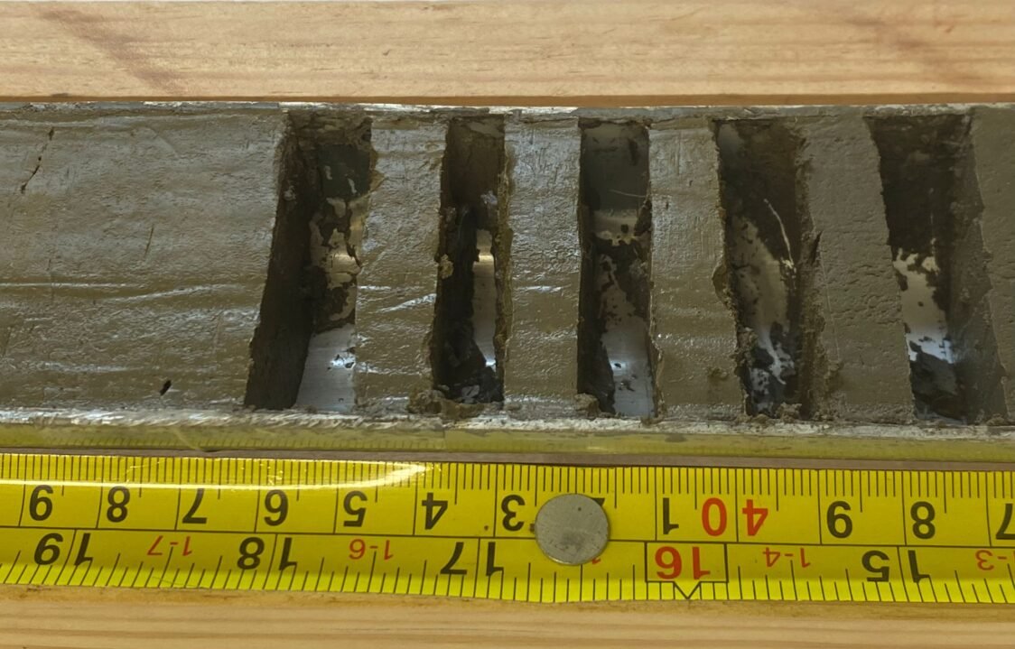
At the center of each forest island, we conduct coring, penetrating till the sterile sediments beneath the archaeological occupation. Our plan is to retrieve approximately 150 cores, each measuring approx. 3,5 meters in length. Given that most of these forest islands are situated in heavily flooded savannahs, often surrounded by extensive swampy soils, access is limited to foot, horse, or specialized all-terrain vehicles designed for such conditions. The hydraulic coring apparatus, towed by the UTV, is employed to reach the center of the forest island. Cores are collected into plastic liners, sealed, labeled, and then transported to ICTA-UAB in Spain.

WP3 – Radiocarbon program and qualitative demographic trends.
The 150 extracted cores undergo radiocarbon dating at each visible stratigraphic transition. In the case of very thick, homogeneous layers, sampling is conducted every 50 cm. Stratigraphic transitions may result from cultural changes, such as the introduction of pottery, environmental shifts, or alterations in land use, such as site abandonment. On average, an estimated 5 to 7 radiocarbon ages are measured for each core. These dates are utilized to construct Bayesian age/depth models. A distinct age/depth model is developed for each site. This approach allows us to assign an age to each analytical result, facilitating a more accurate understanding of the chronological sequence.
Find the resultsWP4 – Geochemistry and quantitative demographic trends
Archaeological sites exhibit distinctive characteristics due to the accumulation of specific elements, primarily derived from human activities, such as food remnants and ash. Therefore, estimating the population size that once inhabited a site can be achieved by quantifying the total amount of anthropogenic elements present. The elemental analysis of cored sediments will primarily focus on total phosphorus (P), the most commonly used element as a proxy for human inputs. Phosphorus is particularly well-preserved in archaeological sites because, when binding with aluminum (Al) and iron (Fe) oxides, it experiences minimal leaching or translocation to different layers.
Find the results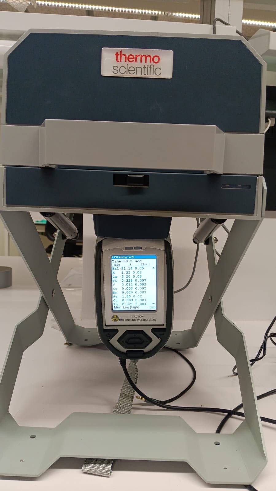
WP5 – Archaeological excavation
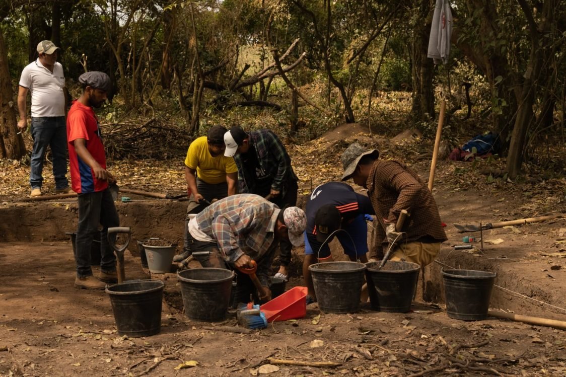
In 2023, two forest islands were excavated, and a third was excavated in 2024. The excavation of a fourth forest island is planned for 2025. The archaeological excavations are primarily conducted by a team of Bolivian and European archaeologists, under the coordination of our collaborators Prof. José Capriles Flores and Sergio Alejandro Calla Maldonado. The excavation objectives include locating, analyzing, and dating pottery, as well as verifying and dating the presence of human burials and assessing the faunal assemblage. In the first year, a total of two pits measuring 4×6 meters and two pits measuring 4×4 meters were excavated.
Find the resultsWP6 – Phytolith analysis
Phytoliths are discrete biogenic silica bodies produced within plant tissues, holding taxonomic significance and generated in abundance by various plant types. In many instances, the shape and size of phytoliths serve as diagnostic markers for the plants that produced them. Notably, phytoliths exhibit minimal movement after deposition, offering a localized signal. Therefore, they act as proxies for the plants that either grew on the same forest islands or were actively transported to them. Within the DEMODRIVERS project, phytoliths will play a crucial role in identifying the period when the first settlers began using or domesticating plants. Additionally, they will be instrumental in tracking the domestication of squash and reconstructing changes in land use and land cover over time.
Find the results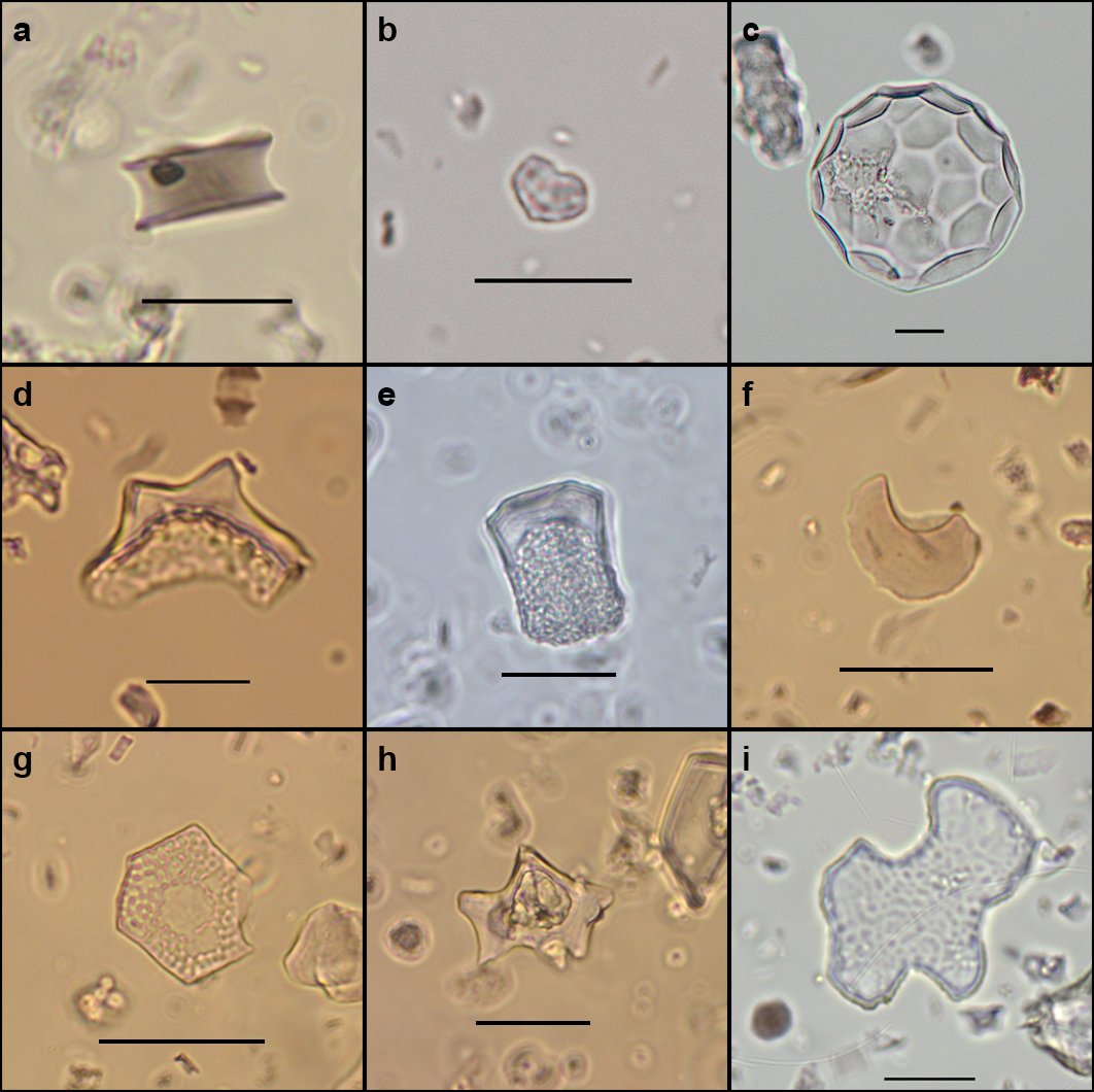
WP7 – Animal Biomarkers
Forest islands sustain a diverse range of animal species throughout the year, encompassing birds, bats, amphibians, reptiles, and small mammals. All vertebrates, humans included, excrete feces that exhibit significant variations in the content and distribution of certain steroids, influenced by diet and bacterial intestinal flora. As these steroids are predominantly insoluble, they endure in the sedimentary record for thousands of years. The steroids found in archaeological sediments provide an avenue for investigating the presence of animals and/or humans. By utilizing a faecal fingerprint reference library, it becomes possible to pinpoint and identify individual animal species. Our analysis of forest island samples will specifically focus on 5β-stanols. This examination aims to establish the relative contributions of humans versus wild animals, serving as a proxy for gauging the intensification of human presence over time.
Find the resultsWP8 – Lake record and cultural continuity
The analysis of pollen and charcoal in a core extracted from an area surrounded by forest islands and pre-Columbian agricultural fields (camellones) serves to unveil both vegetation and fire history, along with evidence of past cultivation practices involving maize, manioc, and sweet potato. Monitoring changes in land use involves examining shifts in the pollen of economically significant taxa (e.g., palms) and disturbance indicators such as Cecropia and charcoal. To discern local patterns from regional signals, the charcoal profile will be meticulously compared with available records from other regions. This comparative analysis aims to provide a comprehensive understanding of the impact of human activities on both a local and broader geographical scale.
Find the results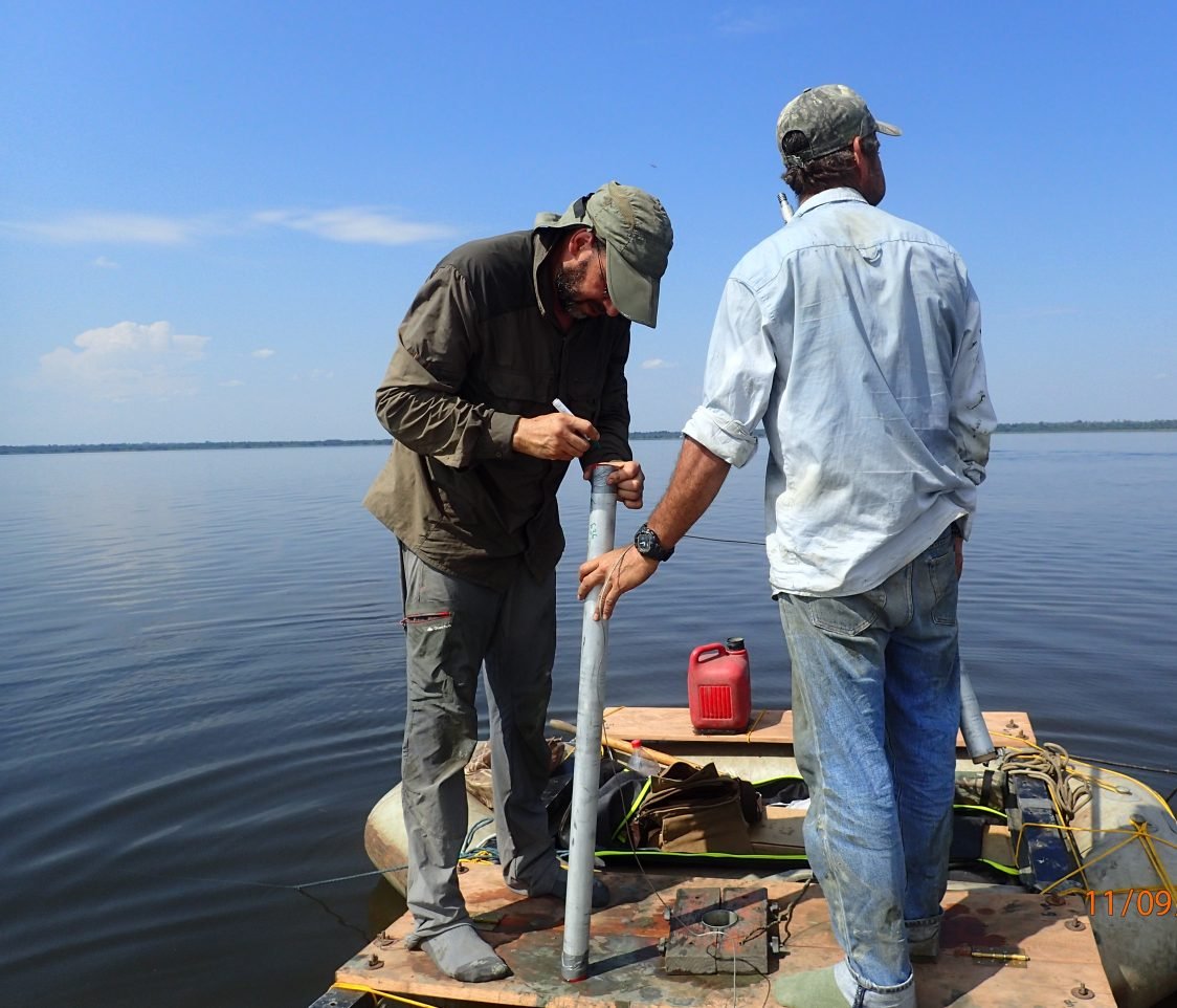
WP9 – Paleo hydrological reconstruction (H/D n-alkanes)
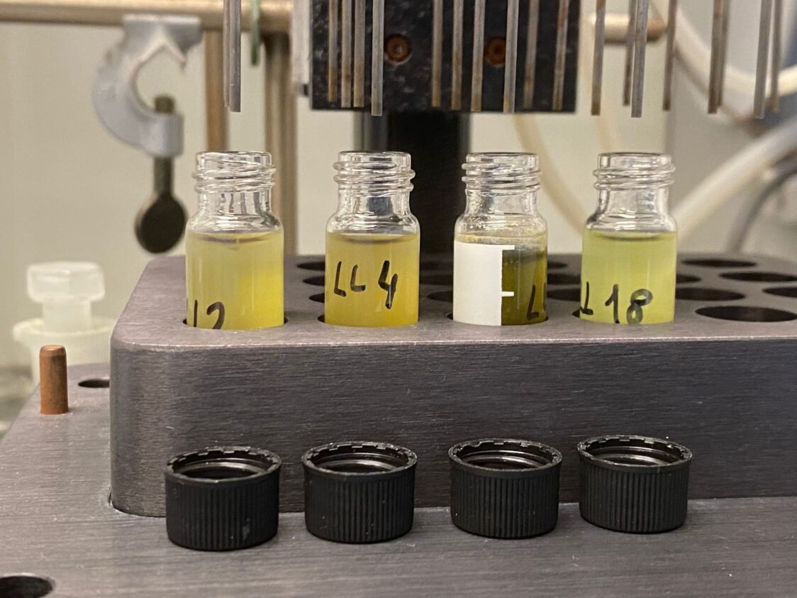
We aim to generate a new, high-resolution paleoprecipitation record for the Bolivian Amazon through the analysis of the hydrogen isotope composition (δD) of plant waxes extracted from forest islands. Plant waxes produced by terrestrial plants contain long-chain n-alkanes, which are refractory compounds preserving both their distributions and isotope compositions. The δD compositions of n-alkanes will be extracted and analyzed from 450 forest island samples at 450 radiocarbon-dated core locations. This comprehensive approach will result in three paleoclimate curves, each corresponding to a specific sub-region, with approximately 150 dated samples for each. The outcome will be a unique and valuable paleohydrologic reference record for the Bolivian Amazon.
Find the resultsWP10 – Landscape evolution
Meandering rivers create oxbow lakes within their floodplains, often susceptible to destruction by successive meanders and infilling from deposited sediments. However, when a river changes its course, oxbow lakes can endure for millennia. Dating organic sediments from the lake bottoms becomes a crucial tool in identifying when the river underwent a course change. We are going to core four oxbow lakes situated along two paleo courses of the Beni River. In addition, following abandonment, some paleo courses of the Beni River experienced neotectonic activity. Notably, a lake formed inside a paleochannel due to fault-induced tilting and slope inversion. To pinpoint the timing of these faults, multiple locations within the lake will be cored. A transect of cores across the fault, inside the paleochannel, will be conducted using a hydraulic corer. This comprehensive approach aims to better constrain the fault’s age. If there was a sufficient time gap between the channel’s abandonment and the fault formation, the cores may reveal a buried organic horizon, enabling us to accurately date the fault occurrence.
Find the results