Methodology
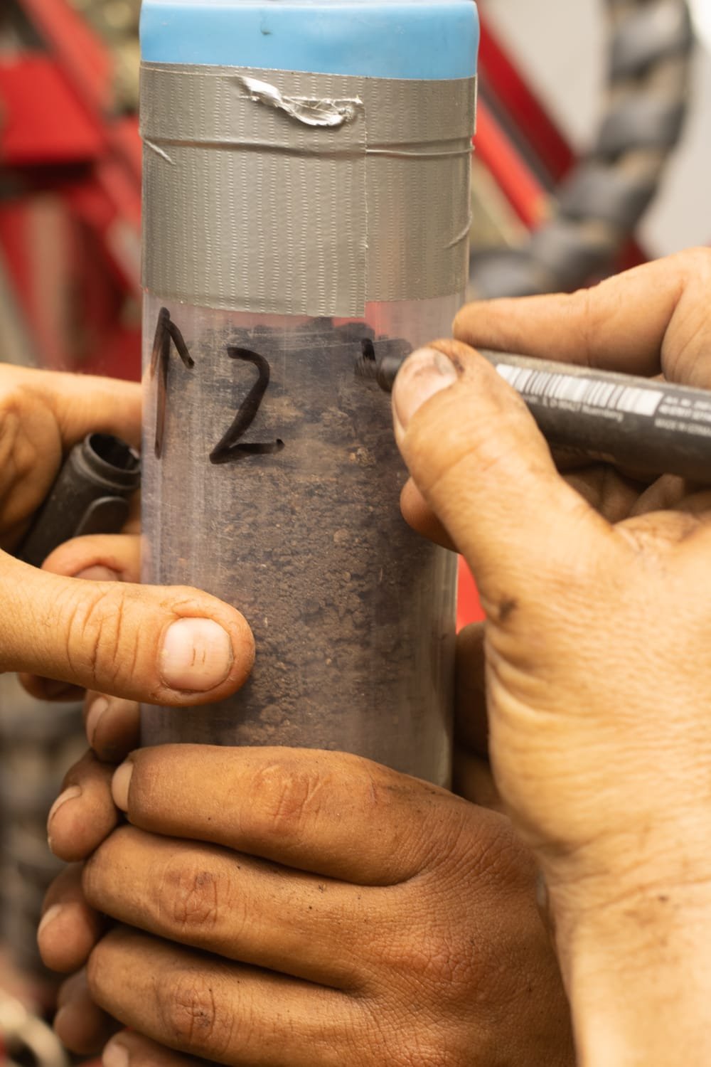
This project will maximize the rich potential of the Llanos de Moxos archaeological record through an innovative approach. We will measure the density of occupation and its spatial and temporal boundaries by studying 150 stratigraphic cores extracted from 100 evenly distributed archaeological sites. Our methodology embraces an interdisciplinary perspective, seamlessly integrating conventional archaeology with cutting-edge disciplines such as geoarchaeology, paleoclimatology, palaeoecology, and artificial intelligence.
A new way to sample archaeological sites.
The innovative methodology employed by DEMODRIVERS, where numerous archaeological sites will be cored as if they were lakes, demonstrates the ability to extract crucial information about past human land use and social organization. This is achieved by combining cutting-edge analytical methods that obviate the need for traditional archaeological excavations. This pioneering approach signifies a new, minimally invasive methodology, addressing a crucial need in the field for studying archaeological sites. DEMODRIVERS showcases how archaeological research can expand its scope from the excavation of a few sites to operating on a regional scale, all while adhering to similar temporal and budgetary constraints.
Find the resultsScaling up phytolith analysis.
We are currently implementing three methodological improvements to enhance the speed and efficiency of phytolith analysis. Firstly, we are refining our phytolith extraction protocol (Lombardo et al., 2016) to expedite the process and scale up the number of samples processed per week. Secondly, we are developing a new standard to optimize the mounting of phytoliths on glass slides for scanning with our Olympus VS200 microscope scanner. Lastly, we are training artificial intelligence systems to identify phytoliths on digital slides. These advancements collectively will enable us to process and analyze more than 2000 phytolith samples within the timeframe of DEMODRIVERS.
Find the results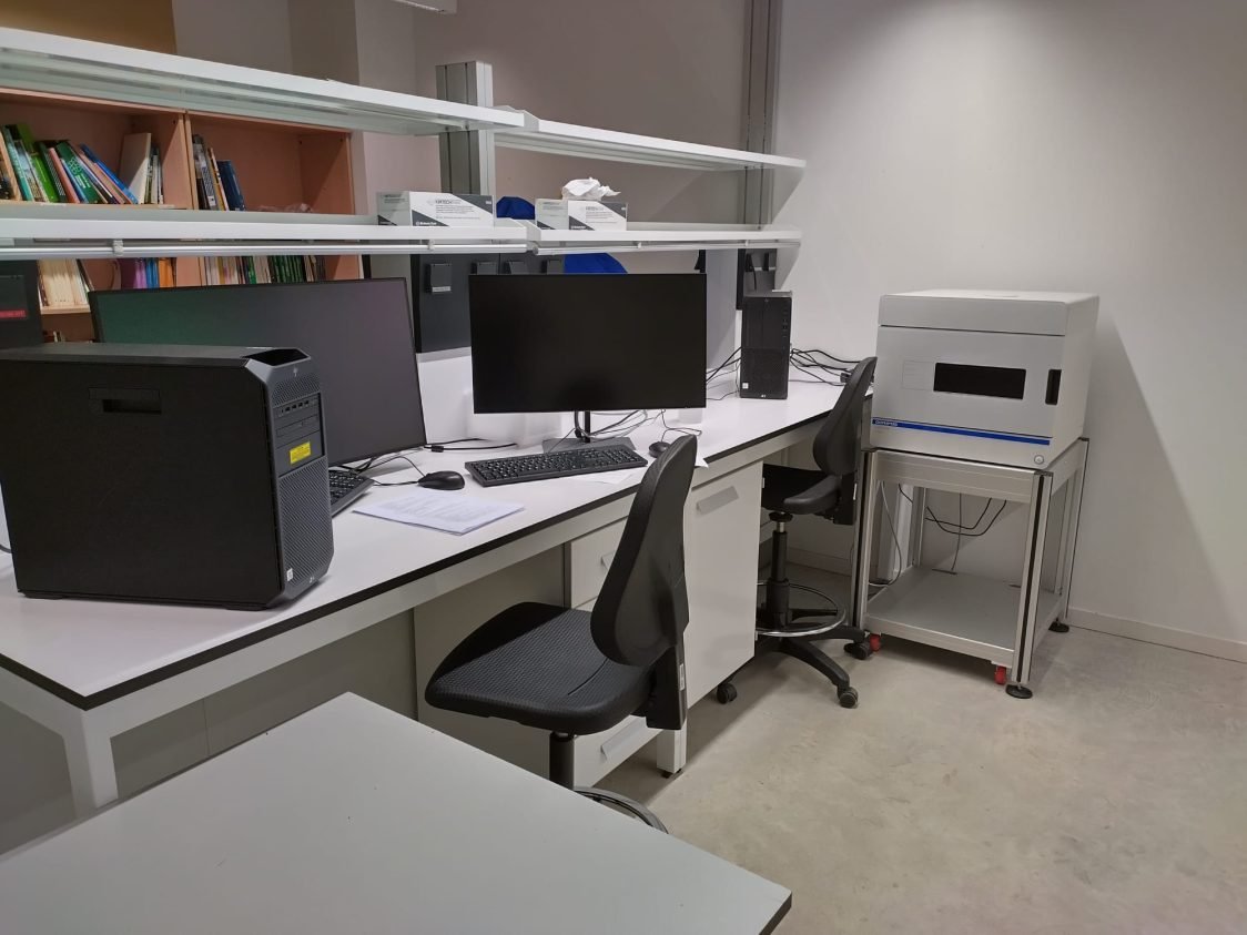
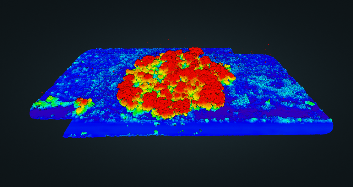
LIDAR surveys.
Laser Imaging Detection and Ranging (LIDAR) plays a pivotal role in modern archaeological research due to its unique ability to penetrate vegetation, revealing the underlying topography. In the context of our archaeological campaigns, we utilize a drone-LIDAR integrated solution provided by DJI. For the acquisition of topographical data of Forest Islands we use the L1 Zenmuse LIDAR sensor, mounted on the Matrice 300 RTK drone and complemented by a D-RTK2 mobile station. This system is easy to transport and deploy. The resulting configuration produces high-quality point clouds characterized by sub-metric accuracy. The sensor can register up to three returns, ensuring the capture of ground points, which are classified later using specific software. Subsequently, the identified ground points are used in the generation of digital elevation models with a resolution of 10 centimetres per pixel. The derived high-resolution DEM is used to extract several morphological parameters, enabling the identification of trends and variabilities within archaeological sites. This approach has allowed us to measure the topography of 59 Forest islands during the 2023 fieldwork season.
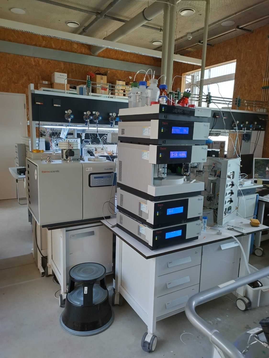
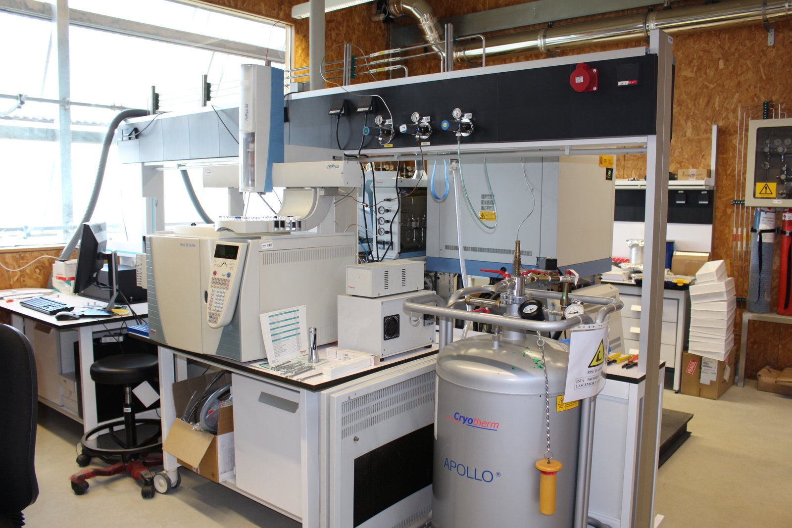
Find the resultsAnalysis of the hydrogen isotope composition (δD)
The hydrogen isotope composition of water changes each time water evaporates (it becomes depleted in heavy isotopes of O and H) or precipitate (it become enriched in heavy isotopes). By tracking the changes in the hydrogen isotope composition (δD) along a stratigraphic profile, we can reconstruct paleo precipitation records. We are doing so by analysing the hydrogen isotope composition (δD) of plant waxes extracted from a lake core and from forest islands. Plant-waxes produced by terrestrial plants contain long-chain n-alkanes which are refractory compounds preserving their distributions and isotope compositions for thousands of years.
This work package is executed in collaboration with Dr. Enno Schefuß at MARUM (Bremen, Germany). n-Alkanes from soils, plants, and forest island samples will be extracted at ICTA, but the compound-specific stable hydrogen isotope analyses for assessing past hydrologic changes will be carried out at MARUM where there is a dedicated laboratory equipped with several mass-spectrometers, ensuring very high precision compound-specific isotope analyses.
Find the results